 Verona Solutions
USGS River Levels & Flows
by Verona Solutions
Is the river
running?
Flow, stage, and the National Weather Service forecast from more than 10,000 official USGS gauges — for paddlers deciding whether a run is in, anglers reading a rise, and anyone who lives where a creek can come up overnight.
Free, including the forecasts
10,000+ gauges
Works offline
No account
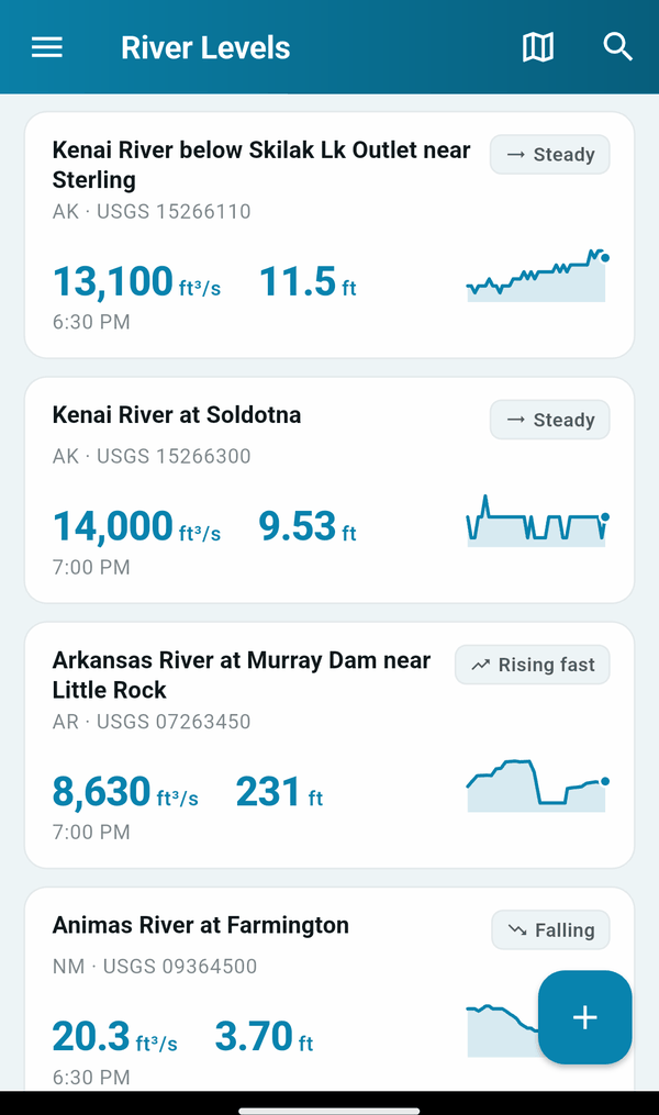
Flow & Stage
In ft³/s and ft, on the axis the station records
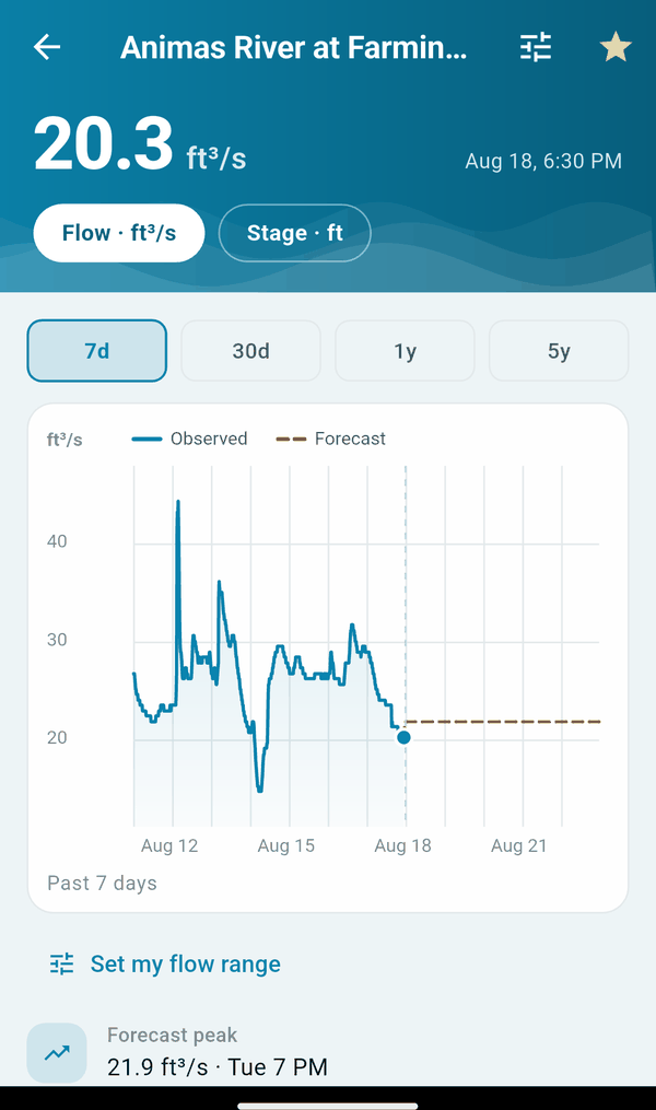
NOAA Forecast
Predicted hydrograph on the same chart
Works Offline
The whole gauge catalogue is on the device
Seasonal Normals
Whether today is high, low, or ordinary
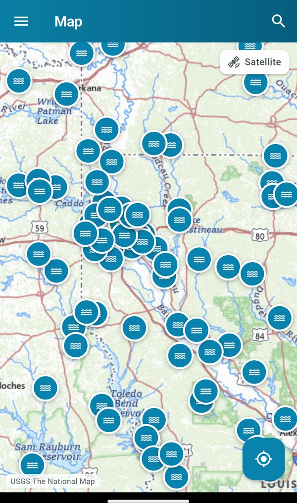
Map & Nearby
Find gauges by looking, or by GPS
Inside the app
Free, including the parts others charge for
What’s included
Free, including the parts others charge for
No account, no subscription, no paywalled forecasts.
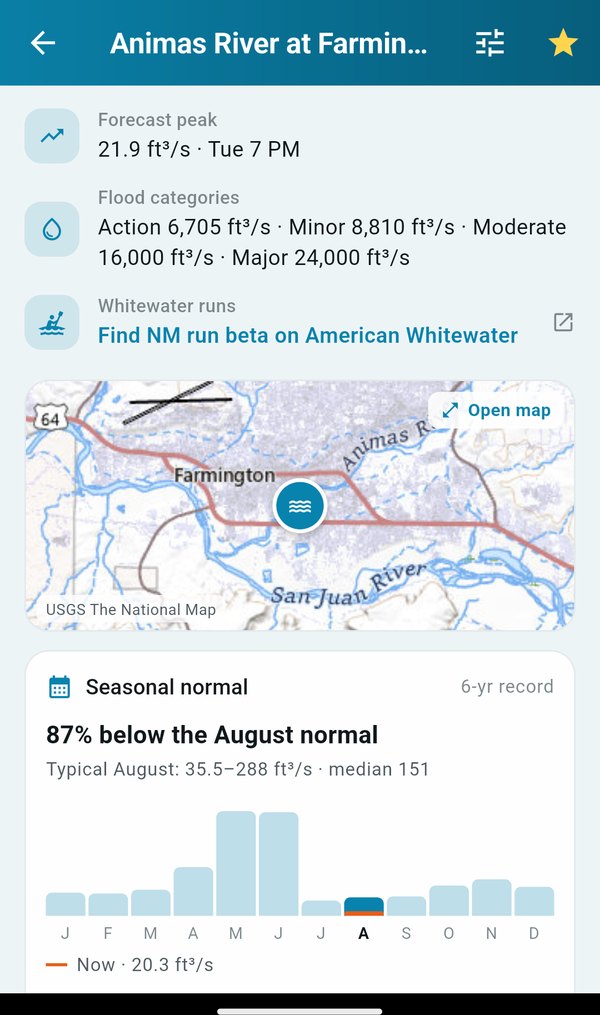
- 10,000+ USGS gauges — across all 50 states and territories, searchable and browsable by state.
- Flow and stage — in ft³/s and ft, on whichever axis a station actually records.
- NOAA forecasts — the predicted hydrograph drawn on the same chart as the observations, up to five days out.
- Years of history — 7 days, 30 days, 1 year or 5 years on any gauge.
- Seasonal normals — what the river typically does each month, so you know whether today’s number is high, low, or ordinary for the season.
- Flood categories — action, minor, moderate and major stages as published by the National Weather Service.
- Your own thresholds — set the range that means “runnable” or “too high” for your river, and see at a glance whether today is in it.
- Works where rivers are — every gauge you star is saved to the phone, and the whole catalogue is bundled — so search and browse work with the radio off.
- Readings labelled with their age — a cached number is never passed off as live.
- Map view and nearby gauges — on USGS topo or satellite basemaps, or by GPS, with browse-by-state sorted A–Z or by distance.
- Whitewater run links — jump to the run beta on American Whitewater where it exists.
- Dark mode — for the same reasons everything else has it.
Honest about the data. Readings come straight from the U.S. Geological Survey and NOAA’s National Water Prediction Service — both public-domain federal sources, and this app adds nothing to them but the reading. Gauge data can be delayed, provisional, or wrong, and rivers are dangerous. Nothing here substitutes for looking at the water, local knowledge, or an official flood warning. Never make a safety decision from a number on a phone alone.
Check the level before you drive out.
Free on Google Play and the App Store.
More from Verona Solutions
Our other apps

IDMyFish
Offline fish ID from a photo
USA Tides Data
Tides & currents, US-wide

Best Times: Hunt & Fish
Solunar times & shooting light
FL Saltwater Fishing Regs
Florida limits & photo ID, offline
DeadOn
Rifle range cards

TrailCam Intel
Trail camera analytics
What’s this Place?
Know where you are
NOAA Buoy & Tide Data
Live buoy, tides & forecasts

ClipVault
Clipboard history for Windows